Vés al contingut

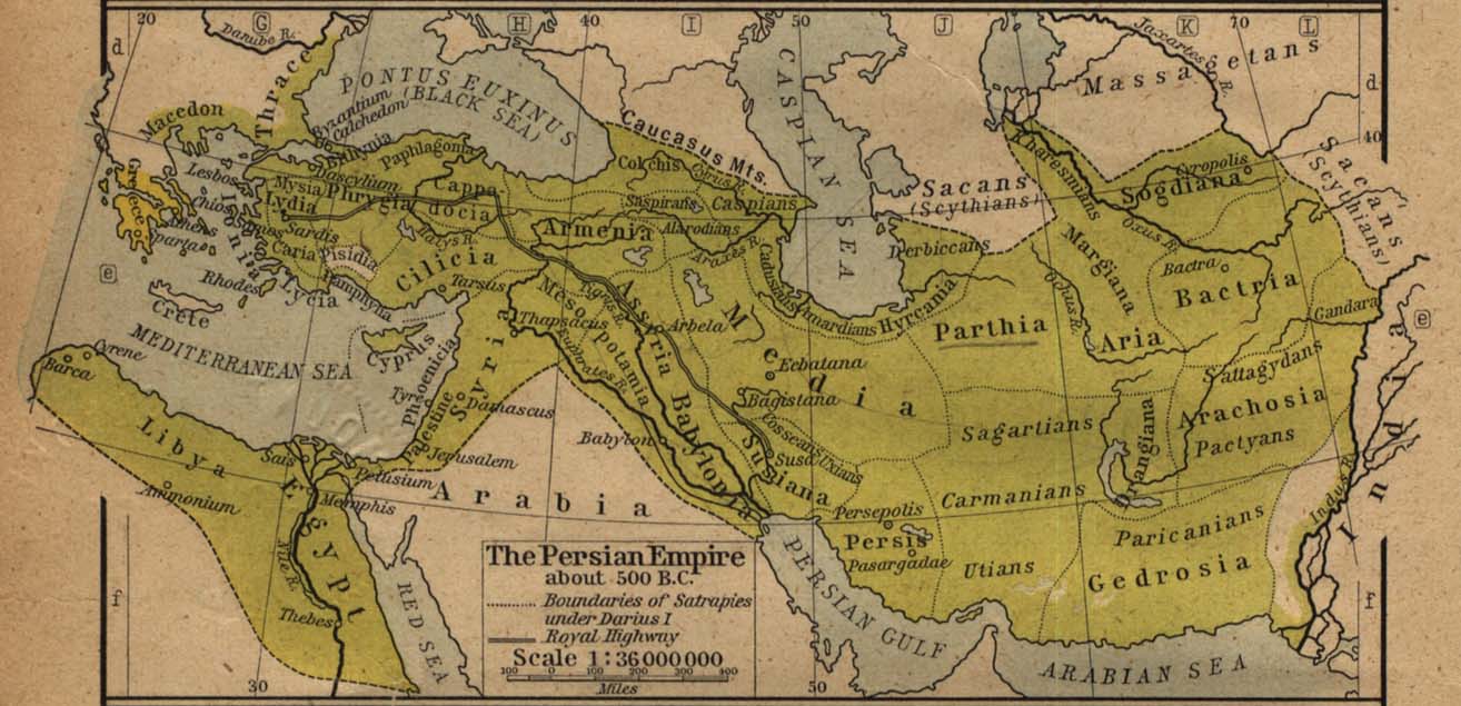
Fitxer:Map of the Achaemenid Empire.jpg

De Viki.cat

Fitxer original (1.314 × 635 píxels, mida del fitxer: 1,1 Mo, tipus MIME: image/jpeg)

File:ImperioAqueménida500AC.svg és una versió vectorial (SVG) d'aquest fitxer. En cas de ser millor, hauria de ser emprada en lloc d'aquesta imatge tramada.

File:Map of the Achaemenid Empire.jpg → File:ImperioAqueménida500AC.svg

Per a més informació pel que fa als gràfics vectorials, llegiu la transició a SVG en Commons.
També hi ha informació quant a la compatibilitat del MediaWiki amb les imatges SVG.

En altres idiomes
Alemannisch  العربية  беларуская (тарашкевіца)  български  বাংলা  català  нохчийн  čeština  dansk  Deutsch  Ελληνικά  English  British English  Esperanto  español  eesti  euskara  فارسی  suomi  français  Frysk  galego  Alemannisch  עברית  हिन्दी  hrvatski  magyar  հայերեն  Bahasa Indonesia  Ido  italiano  日本語  ქართული  한국어  lietuvių  македонски  മലയാളം  Bahasa Melayu  မြန်မာဘာသာ  norsk bokmål  Plattdüütsch  Nederlands  norsk nynorsk  norsk  occitan  polski  prūsiskan  português  português do Brasil  română  русский  sicilianu  Scots  slovenčina  slovenščina  српски / srpski  svenska  தமிழ்  ไทย  Türkçe  татарча / tatarça  українська  vèneto  Tiếng Việt  中文  中文(中国大陆)  中文(简体)  中文(繁體)  中文(马来西亚)  中文(新加坡)  中文(臺灣)  +/−
Nova imatge SVG

Descripció
Español: Mapa histórico del imperio Aqueménido.
English: Historic map of the Achaemenid Empire
Français : Carte historique de l'empire achéménide
فارسی: نقشهٔ تاریخی از گسترهٔ شاهنشاهی هخامنشیان
Data
Font
Autor
William Robert Shepherd (1871–1934)  wikidata:Q8017647 s:en:Author:William Robert Shepherd
 
William Robert Shepherd
Altres noms
William R. Shepherd; William Shepherd
Descripció cartògraf i historiador nord-americà
Data de naixement i defunció 12 de juny de 1871 Edita-ho a Wikidata 7 de juny de 1934 Edita-ho a Wikidata
Lloc de naixement i defunció Charleston Edita-ho a Wikidata Berlín Edita-ho a Wikidata
Lloc de treball
Control d'autoritats
creator QS:P170,Q8017647
Permís
(Com reutilitzar aquest fitxer)
Public domain
This work is in the public domain in the United States because it was published (or registered with the U.S. Copyright Office) before January 1, 1931.

Public domain works must be out of copyright in both the United States and in the source country of the work in order to be hosted on the Commons. If the work is not a U.S. work, the file must have an additional copyright tag indicating the copyright status in the source country.
Note: This tag should not be used for sound recordings.PD-1923Public domain in the United States//commons.wikimedia.org/wiki/File:Map_of_the_Achaemenid_Empire.jpg
Altres versions

Llegendes

Afegeix una explicació d'una línia del que representa aquest fitxer
Historic map of the Achaemenid empire at its greatest extent

1.152.339 byte

635 píxel

1.314 píxel

Historial del fitxer

Cliqueu una data/hora per veure el fitxer tal com era aleshores.

Data/horaMiniaturaDimensionsUsuari/aComentari
actual12:07, 16 gen 2019Miniatura per a la versió del 12:07, 16 gen 20191.314 × 635 (1,1 Mo)wikimediacommons>Pataliputra!clarified

Les 3 pàgines següents utilitzen aquest fitxer:

Metadades