

Fitxer:Kurdish-inhabited areas of the Middle East and the Soviet Union in 1986.jpg

Mida d'aquesta previsualització: 748 × 600 píxels. Altres resolucions: 299 × 240 píxels | 599 × 480 píxels | 958 × 768 píxels | 1.190 × 954 píxels.
Fitxer original (1.190 × 954 píxels, mida del fitxer: 288 Ko, tipus MIME: image/jpeg)

Aquest fitxer i la informació mostrada a continuació provenen del dipòsit multimèdia lliure Wikimedia Commons.
 Vegeu la pàgina original a Commons
 Vegeu la pàgina original a Commons


 Any autoconfirmed user can overwrite this file from the same source. Please ensure that overwrites comply with the guideline.
Resum
| Descripció |
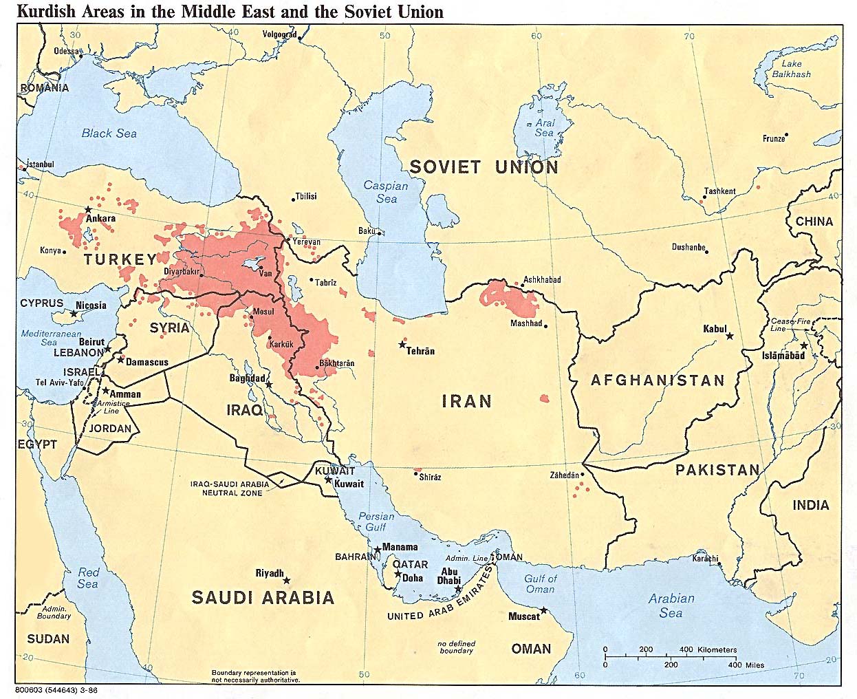
English: Kurdish-inhabited areas of the Middle East and the Soviet Union in 1986 |
| Data | |
| Font | 800603 (544643) 3-86 |
| Autor | U.S. Central Intelligence Agency |
| Permís (Com reutilitzar aquest fitxer) |
See the list of maps at http://www.lib.utexas.edu/maps/iraq.html for a link to this map and related maps. That page says: "The following maps were produced by the U.S. Central Intelligence Agency, unless otherwise indicated." This particular map is labeled there as "Kurdish Areas in the Middle East and the Soviet Union. 1986." |
| Altres versions | File:Kurdish language.jpg |

Llicència

|
This image is a work of a Central Intelligence Agency employee, taken or made as part of that person's official duties. As a Work of the United States Government, this image or media is in the public domain in the United States.
|

|
Historial del fitxer
Cliqueu una data/hora per veure el fitxer tal com era aleshores.
| Data/hora | Miniatura | Dimensions | Usuari/a | Comentari | |
|---|---|---|---|---|---|
| actual | 16:32, 27 jul 2022 | | 1.190 × 954 (288 Ko) | wikimediacommons>Eidiporia2 | The user vandalized a historical map |
